

How Roman Surveyors Helped The Empire Create Straight Roads Thousands Of Years Ago
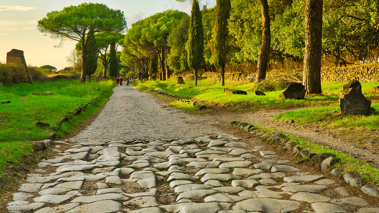
After all this time, the ancient Roman Empire somehow still has its grubby paws all over the modern world. You can see its legacy in the use of Latin in fields like law and taxonomy, or the use of the Latin alphabet for languages around the world. The Empire's influence is also all over modern engineering, from using aqueducts to move water and concrete to construct buildings to the complex, sprawling system of roads that spanned from Europe through the Middle East and into North Africa.
Many of those roads still exist in one form or another today, and they're remarkably straight and well-engineered. In fact, if you went back in time to visit the territories of the Roman Empire, the network of roads you'd find there might remind you of the U.S.'s complex interstate highway system. Only with fewer pickup truck drivers crashing into crowds and killing people, and more marching legions traveling between conquests.
The methods used to plot and construct these strikingly straight roads have been the subject of much research, and the process looks surprisingly familiar to how we build roads now. The Romans' trick was to use thorough surveying teams, aided by impressive instruments, to map out paths as direct as possible to their destination. At least when it was practical. They still adjusted their designs around an area's topography.
Among the tools used in Roman road-planning, the three most notable are the dioptra, the chorobatus, and the groma. The dioptra was like a mounted spyglass used to survey an area from a distance, and the chorobates might have functioned like a long level. The key item used by surveyors was the groma, which was used to align the road's origin and destination to a near-perfect ray.
Ancient Roman surveying tools weren't too shabby
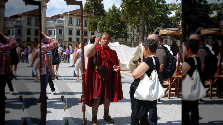
Unfortunately, there are no surviving examples of the dioptra or chorobatus from the time period, but they're described in ancient Roman texts. The dioptra likely had many designs, but it generally consisted of a base, a stand, and a sighting instrument. A chorobates measured about 20 feet long and consisted of a single long beam, a supporting leg on each side, and two plumb lines on either end. These lines used gravity to show the incline of the measured surface. It could precisely level a flat stretch of road or determine the grade of an incline and the elevation at the top of a hill.
It's easy to imagine how incredibly useful these tools would've been thousands of years ago, but neither of them guarantees your road will lead directly to its destination, especially when covering vast distances. The groma was the Roman engineers' key to precision plotting. It was a long, straight pole with cross-shaped beams affixed to the top. From the ends of each beam hung a weighted plumb line. Roman surveying crews would build beacons some distance apart at approximately equal distances along a straight line between their origin and destination, and then use a groma at each beacon to align them.
This involved traveling back and forth between the non-terminal beacons and aligning the groma's plumb lines with the beacons directly before and after the site where the engineers were working. If the groma indicated that the three beacons didn't form a straight line, one of the beacons was shifted accordingly. It would've taken some iteration, but this eventually allowed engineers to dial in a straight line through each beacon, connecting destination and origin as directly as possible.
The legacy of Roman roads
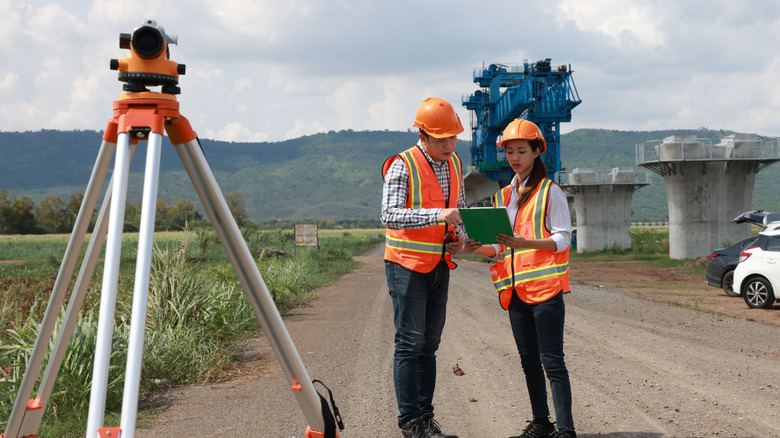
The Roman Empire existed for nearly 500 years, and road-building techniques would've varied across different eras and areas. While magnificent, Roman roads were not a monolith. That said, the roads of ancient Rome were more modern than you might expect, and many of their road-building strategies remain relevant today. The Empire's advanced surveying and plotting techniques feel not so different from modern methods, for one.
Additionally, Roman roads were built in layers with solid foundations and were even cambered to allow for water to drain away without causing damage. It's likely that these techniques have played a role in the preservation of these roads, many of which still exist today, and such methods are employed in modern road construction.
Rome's network of roads covered tens of thousands of miles across three continents, and their primary purpose was to transport troops to the Empire's various territories or to the edges of the realm to help with the Empire's conquests. This mirrors the origins of the U.S. interstate system as, among other things, a reliable means responding to military threats coast to coast. Despite the similarities between our roads—separated by thousands of years—we probably can't blame the ancient Romans for America's car-centric design.