5 US National Parks With Famously Scenic Drives
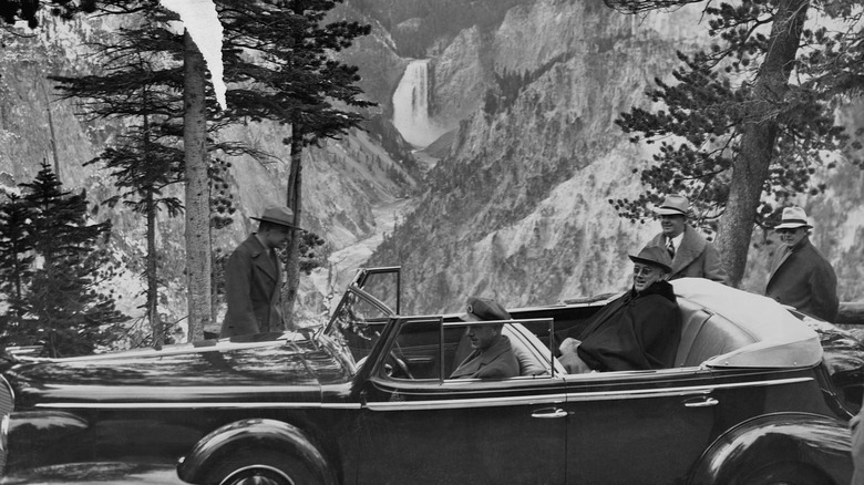
No doubt better known for helping the United States defeat the racist traitors of the Confederacy, Ulysses S. Grant also made his mark in the battle against environmental exploitation. As president, in 1872, he signed the Yellowstone National Park Protection Act, creating the country's first national park. And it was only a few short years after that that Yellowstone got its first roads.
It happened under the direction of the park's second superintendent, Philetus W. Norris, who plotted out a course for a rudimentary system of roads that would help folks better explore the park. In fact, some of them eventually evolved into the Grand Loop Road that provides great views of Yellowstone today — you just have to make sure you don't crash your car into a 105-degree Yellowstone geyser.
Actually, there are now more than 400 national parks, monuments, historic sites, and other parts of the National Park System across the country, and many make great locations for scenic cruising. Just consider our list, which features some of the top choices for drivers who want to go a little wild.
Glacier National Park
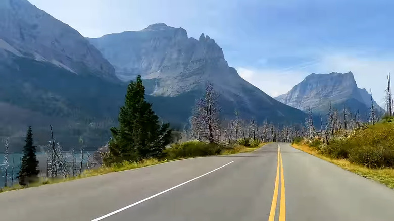
You'll have to be in a rush to catch the best parts of Glacier National Park in northwest Montana. Its most notable features — the glaciers — have been steadily melting pretty much ever since white people came to the area. For example, approximately 150 glaciers were reported in the vicinity in 1850, which, to be clear, was well before the park was founded: Although there are signs that indigenous people were within its current boundaries some 10,000 years ago, it wasn't until the 1870s that white people began exploring the area, and the park wasn't established until May 11, 1910. By 1968, an aerial survey counted only 83 bodies of ice and snow of any significant size. Today, the National Park Service lists a mere 26 glaciers in the park, while NASA recognizes 25.
Still, a road trip along the park's iconic Going-to-the-Sun Road offers a breathtaking 50-mile journey across the Continental Divide, giving you a rare chance to see one of those ice rivers — Jackson Glacier — right from your car. You'll also be able to take in the rugged peaks of the surrounding Rockies, which includes traveling the Logan Pass, more than 6,600 feet above sea level. You may not be alone, however, as mountain goats and bighorn sheep also travel the pass.
Building the road was an impressive feat of engineering. The project began with a budget of $100,000 in 1921 but wasn't finished until 1933 — at a total cost of over $2 million (more than $50 million when adjusted for inflation).
Natchez Trace Parkway
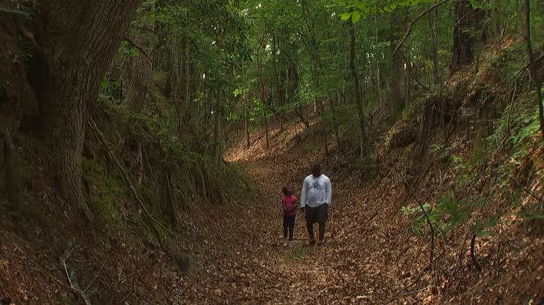
Technically, the Natchez Trace Parkway is exactly that: a "parkway." According to the Transportation Research Board, that means it's a "federally owned, elongated park featuring a road designed for pleasure travel, and embracing scenic, recreational or historic features of national significance." Yet it's still considered a part of the National Park Service, which says it's "considered one of the most scenic and beautifully designed parkways in America." There's certainly no shortage of natural sights to enjoy along the way, from the southern parkway's bayous and swamps to the limestone formations and caves in the route's more northern reaches.
The road winds 444 miles through what's now Tennessee, Alabama, and Mississippi, but used to be home to the Natchez, Chickasaw, and Choctaw nations. Moreover, much like Glacier National Park, the area contains traces of human habitation that go back 10 millenia. You'll be able to check out a number of ancient burial mounds and indigenous sites during the ride, which includes drivable sections of the early-1800s path that offer a taste of what travel was really like two centuries ago. (Note that RVs and buses aren't allowed on these parts of the path, which is too bad, since rising costs mean more Americans are bailing on houses and moving into RVs instead.)
You should further know the parkway doesn't shy away from the area's more tragic history, recognizing the old Trace was used as a route for taking enslaved people to the town of Natchez, Mississippi for sale. Indeed, an old plantation has been kept standing along the parkway as a sad reminder of the times.
Padre Island National Seashore
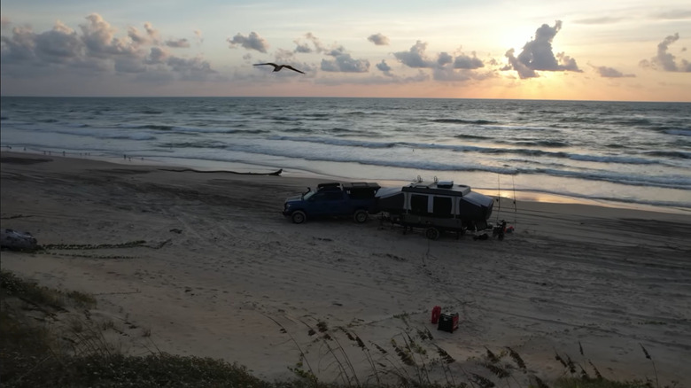
Sure, there's plenty of wildlife to be found on South Padre Island, but if you're more interested in a relaxing journey along 66 miles of untamed coastline, the Padre Island National Seashore could be the perfect choice. (For those who aren't experts on Texas geography, Padre and South Padre are both barrier islands located off the state's coast in the Gulf of Mexico [renamed the Gulf of America in 2025 by President Donald Trump], but they're separated by some 200 miles of water.)
Traveling the beaches of South Padre Island won't be quite like the old Speed Weeks held literally on Daytona Beach, but going slower lets you get a better look at some of the exotic-looking birds that make the island home. Depending on when you visit, you could see snowy egrets, white ibises, long-billed curlews, sandhill cranes, white and brown pelicans, and other of our feathered friends. An additional benefit of motoring along the beach is that driving provides the only access to some of the island's most remote and rewarding sites, highlighted by Little Shell Beach, Big Shell Beach, Yarborough Pass, and Mansfield Channel. In some place, you may even come across sea turtles coming and going to their nests.
All this comes with some warnings from the National Park Service, though. For one thing, front-wheel-drive vehicles are only allowed on very short stretches of the beach. The difference between four-wheel drive and all-wheel drive could affect performance elsewhere in some cases, yet 4WD and AWD vehicles are both allowed along the full route.
Acadia National Park
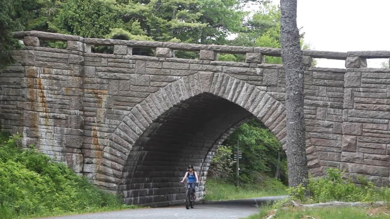
Our next stop is what the Park Service calls the "Crown Jewel of the North Atlantic Coast": Acadia National Park in Maine — one of the worst states for EV range, by the way. The park makes it especially easy to get around, with 158 miles of hiking trails, 45 miles of traditional carriage roads made from broken stone with the occasional granite-block guardrail, and 27 miles of relatively modern road meant for today's cars — those carriage roads are for biking, walking, and, yes, horse-drawn carriage rides. They were the brainchild of John D. Rockefeller Jr., who, as a summer resident of nearby Seal Harbor, provided the driving force — and bank account — to create them. He even worked himself on the project.
Speaking of driving, you can currently travel along that 27-mile Park Loop Road to discover places like Mount Desert Island, the sixth largest island in the contiguous United States and home to much of the park, and Cadillac Mountain, at 1,530 feet the highest point on the East Coast. Meanwhile, the coast puts on a constant show of thunderous waves and craggy rocks, and an interesting range of mammals can be found in the park, taking advantage of a landscape highlighted by not just the rocky seashore, but also the surrounding forest.
Flying mammals? Check and double check. Mammals covered in sharp pointy quills and others covered in silky soft fur? Certainly. Playful river creatures? Naturally. Plus, beyond the bats, flying squirrels, porcupines, mink, and otters, you may be able to catch sight of the fastest animal in the world, the peregrine falcon.
Death Valley National Park
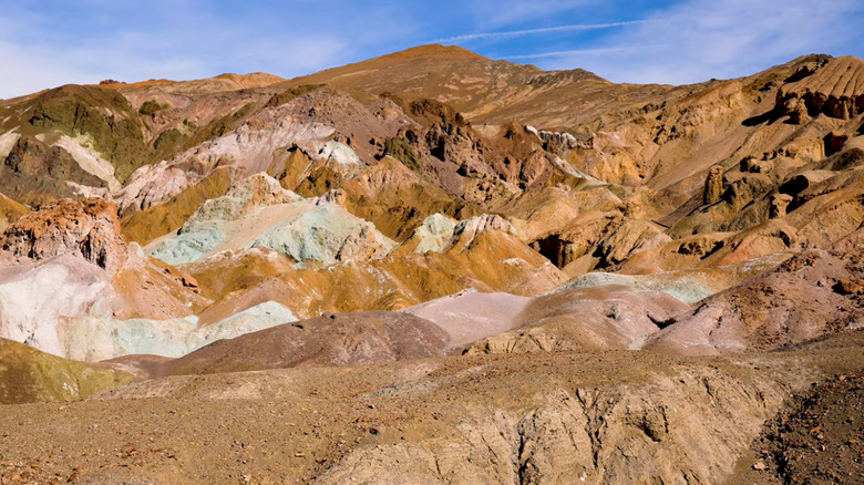
Sure, Death Valley is one of the hottest, driest, and lowest places on the planet, where the summer forecast often calls for temps of 120 degrees Fahrenheit — in the shade. But it's also uniquely designed for driving: No other national park has more miles where cars are allowed to travel than Death Valley. There you'll find nearly 1,000 miles of paved and dirt roads, and don't worry, that still leaves about 93% of the park's 3.4 million acres as protected, road-free wilderness.
Some of the most beautiful of those miles go through the aptly named Artists Palette. It's an area where ancient volcanoes left behind mineral deposits that add a colorful touch to the rocky and forbidding geography, creating a landscape patched in a striking spectrum of shades from red through blue. The view makes for a bold contrast with the white of the vast salt flats you can also see on the route. You're unlikely to see racing champions set land speed records there, like you might at the Bonneville Salt Flats in Utah, but there are areas where you can park and walk on the salt yourself.
Just remember that while the park is well-suited for backcountry driving with all those roads, the backcountry can be flat-out deadly during a breakdown. So there is a long list of precautions to follow before you set out on a journey, and they're no joke. Perhaps the most important is that you follow a detailed, old-school physical map instead of trying to rely on your vehicle's nav system. The last thing you want to do is follow Google Maps into a desert-road nightmare.