These Are The Oldest Roads In The U.S. Still Being Used Today
Just like you, dear reader, we at Jalopnik live for the love of cars, motorcycles, and aircraft. The racetracks, the roar of multi-cylinder machines, the speed, and the smell of burnt clutches and melting rubber are more stimulating than a double shot of espresso. Okay, maybe not espresso, we love that stuff, but you get the point, right? Heck, we've even got a bucket list of roads we'd love to drive. With this passion, comes the love for speed, and that speed turns the scenery into a blurry streak and bends time between corners. Some of us prefer to lift off the gas and trade the track for a quiet backroad, finding joy in the journey itself.
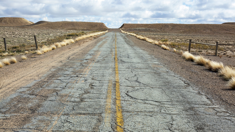
This one is for the love of open roads and, very specifically, some of the oldest U.S. thoroughfares that are still in use today. These are paths that once carried Native Americans, post riders, colonists, stagecoaches, and, later, cars. But America's road system was carved, argued over, and paved 1 mile at a time until it became the sprawling network that we drive on today. Muddy wagon trails eventually became the blueprint for modern roads, and every era added its own layer of history. The U.S. road system now manages nearly 8 billion vehicle miles a day.
Some of the oldest roads have been widened, paved, rerouted, and renamed. They run through bustling towns and sleepy suburbs, quietly reminding us that the foundations of American travel were laid centuries ago. Here's a tip of the hat to some of the oldest roads in America that are still open to everyday traffic, each one being a living time capsule for modern wheels.
Old Mine Road
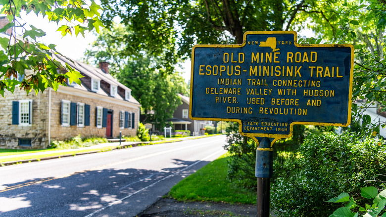
Theorized to have been carved out first by Native Americans and then by Dutch settlers in the 1600s, Old Mine Road is one of the oldest commercial routes in North America. This is a 100-mile stretch running from Pahaquarry, New Jersey, to Kingston, New York. What began as a colonial ore-hauling trail now cuts through the Delaware Water Gap National Recreation Area. In New Jersey, it still holds its pre-Revolutionary charm, with overgrown shoulders, sagging barns, and the occasional colonial relic hiding in the woods.
The road has seen its share of drama. A doomed plan to build the Tocks Island Dam in the 1970s emptied nearby towns, forcing 4,000 families to relocate under the federal government's relocation program. The dam was never built, but the ghosts remain, with entire communities displaced for a reservoir that was never filled. Today, the National Park Service keeps the corridor undeveloped, allowing the forest to reclaim what industry abandoned.
There are many ultimate summer road trips that we would love to go on around the world, but, right here at home, there are hidden gems like the Old Mine Road. Driving the Old Mine Road feels like flipping through the oldest chapters of American travel. The surface shifts from smooth asphalt to gravel and is littered with craters, so you'll want something taller than a Miata to survive the potholes. For those willing to crawl through its curves, the reward is silence, solitude, and history that predates automotive horsepower.
King's Highway -- Boston Post Road
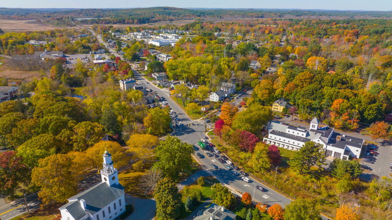
The King's Highway was commissioned by King Charles II in the 1650s and completed around 1735. This was America's first arterial road that stretched nearly 1,300 miles from Charleston, South Carolina, to Boston, Massachusetts. The section between Boston and New York opened in 1673 and doubled as the colonies' first postal express lane, earning it the name Boston Post Road. Fittingly, the King's Highway, and in particular the Boston Post Road, is considered the oldest stretch of road in the United States.
The Boston Post Road snaked through the mountains of western Massachusetts, skirted the shores of Long Island Sound, and carved across the green expanse of the Connecticut River Valley. What started as dirt and hoofprints eventually evolved into the Northeast's modern highway backbone. Though the dirt tracks have been replaced with smoother pavement, the route still embraces the same landscape that Native Americans and early settlers once crossed centuries ago.
The Upper Post Road ran from New Haven through Hartford and Springfield to Boston and was lined with taverns for weary travelers. The Lower Post Road, now U.S. Route 1, cut along the coast through Providence before turning toward Boston. Today, the Middle Post Road is traced by Routes 16 and 109 — this was the shortest section, and it was also once the most dangerous, thanks to King Philip's War.
Old Albany Post Road
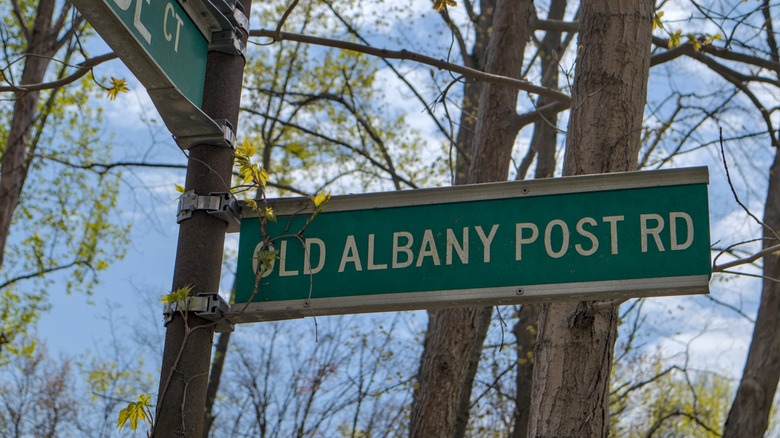
Officially established in 1669, the Albany Post Road followed Native American trails once used by the Wappinger and Wicopee tribes, connecting what was then New Amsterdam (New York) to Albany. By 1703, the British turned it into a "Publick Highway" under Queen Anne's rule, rebranding it as the Queen's Road, a fittingly royal title for a route that still refuses to be tamed.
At over 350 years old, this winding 6-mile stretch in Philipstown, New York, has never been paved. It's New York's oldest road, and the United State's second-oldest after the Boston Post Road. This particular section of historic significance is called the Old Albany Post Road, and it has seen everything from George Washington's troops to Benjamin Franklin's mile markers, which still stand on its tree-covered shoulders today.
Locals treat it like sacred ground. The Old Road Society of Philipstown, New York, an all-volunteer group founded in 1982, has spent decades fighting to preserve its unpaved character, battling every well-meaning official with a bucket of asphalt. Their mission clearly is to keep the past intact, potholes and all. Most of the original Albany Post Road has been absorbed into modern roads, but this 6-mile dirt section endures, and it was recognised and added to the National Register of Historic Places in 1982.
Mohegan Road -- Connecticut Route 32
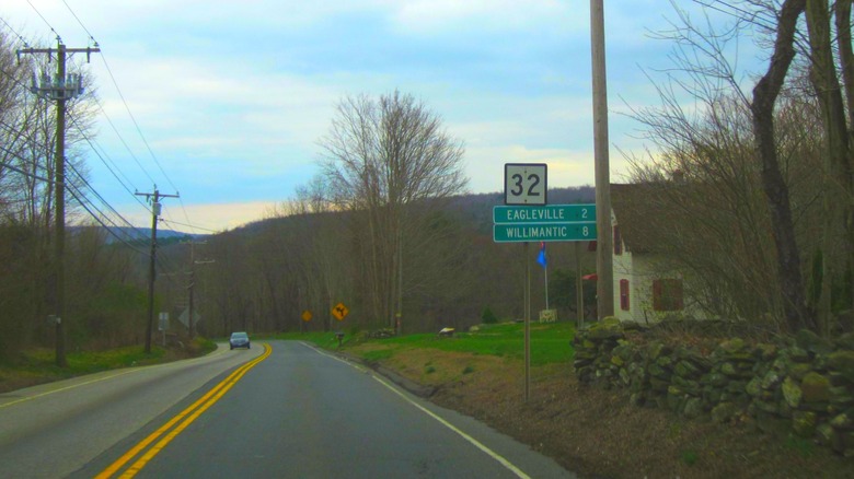
Long before Connecticut had interstates and traffic jams, there was Mohegan Road. First laid down in 1670 between New London and Norwich in Connecticut along the east bank of the Thames River, it was previously a well-trodden Native American path, used for over a century. The colonists simply widened it, gave it a name, and turned it into one of New England's first proper highways.
By 1792, Mohegan Road leveled up to become New England's first turnpike, and only the second turnpike in the entire United States. Travelers rolled their wagons across its ruts, and the route became a commercial lifeline for Connecticut's growing towns. When the age of numbered highways arrived, the road was folded into the New England Interstate system, reborn as Route 32 in 1922.
Today, Route 32 still follows much of that original colonial alignment, snaking through eastern Connecticut's forests and small towns, from New London's coast to Willimantic's hills. It's hard to imagine that this modern two-lane stretch once carried ox carts and post riders. Three centuries later, it's still doing what it was built for, connecting people, commerce, and a slice of New England's oldest road history. Sometimes, driving on the back roads is more satisfying than flying down the interstate, and when those roads come with a side of history, that's just the cherry on top of a perfect drive.
Farm Highway -- Connecticut Route 108
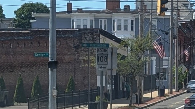
Before it was just another numbered connector in southern Connecticut, Route 108 had one of the longest pedigrees in the state. The story begins way back in 1696, when the Farm Highway, today's Nichols Avenue section of Route 108, became Trumbull's first highway. Built to link farms and settlements between Norwalk and New Haven, it's considered Connecticut's third-oldest documented highway, behind only the Mohegan and Boston Post Roads.
Fast forward two centuries to the 1920s, and the number 108 didn't even belong to Trumbull. Back then, State Highway 108 ran on the New State Road and Tolland Turnpike between U.S. 6 and Route 83 in Manchester, before continuing north into Massachusetts. The modern Route 108 as we know it wasn't commissioned until January 1, 1932, and at first, it didn't get much love. The road ran just 3.45 miles from a dead end in Huntington village to Perry and White Streets in Shelton, with no real connections to other state routes – it was basically a lonely local shortcut with a fancy number.
Things slowly improved. A 1951 state senate bill pushed for an extension from Shelton to Penny Avenue in Trumbull, followed by a southward expansion in 1952. It briefly vanished from maps in 1957, only to reappear in 1960. By 1963, Route 108 finally earned its respect when an extra 3 miles were added via Nichols Avenue from Route 8 to U.S. 1, upgrading it from forgotten farm track to legitimate thoroughfare.
Three centuries later, Route 108 remains proof that some roads do survive history, and while it may not be one of the great places you would want to go with your car, it's still a vital part of America's road-network past.