Most Weather Planes Still Rely On Propellers: Here's Why
Tracking the weather is more important than ever now that we're seeing record breaking storms nearly every year. According to Climate Central, the number of weather incidents causing more than a billion dollars of damage has jumped from approximately three per year in the 1980s to close to 20 events per year over last five years. For the past two years, that number has spiked to 28 and 27.
With that in mind, storm chasers obviously want to choose the best kind of plane to handle the job, and guess what? That's not some sort of high-tech jet. Most weather planes these days still rely on propellers — turboprops, to be exact.
Now, turboprop planes generally fly slower, lower, and with less range than jets, but none of that usually matters when you're hunting hurricanes and the like. In fact, a slower speed is an advantage because a weather plane needs to maximize its time inside the storm to gather data, not zip right through it at a high speed or, like Spirit Airlines, fly over a hurricane.
As for altitude and range, turboprops actually perform better and more efficiently than jets at lower heights, where the action is, and their ability to take off and land in small airports or grassy fields outweighs their shorter ranges since not all hurricanes and storms take place near a convenient, jet-friendly airport with concrete runways.
How does a turboprop engine work
You might not be able to tell from the propeller blades out front, but a turboprop actually works just like a typical gas-turbine jet engine on the inside. In both setups, turbine blades draw air into the engine, where it's compressed, mixed with fuel, and then ignited. Power comes from the combustion process, and it's what that power does that makes the difference in turboprops and jets. In the former, the pressure of combustion is used to spin the propeller. A jet, on the other hand, moves forward from the pressure of the combusted fuel being forced out of the engine nozzle.
Now, some aviation insiders mention that a turboprop's propeller blades help protect against hail damage by preventing pieces from getting into the air intake and damaging the engine. But remember, jet engines must pass rigorous federal testing specifically for things like hail damage, bird strikes, and other foreign object damage. Despite the occasional jet engine sucking in a rabbit and catching on fire, flying remains much safer than driving even today.
What are the top weather planes in the United States?
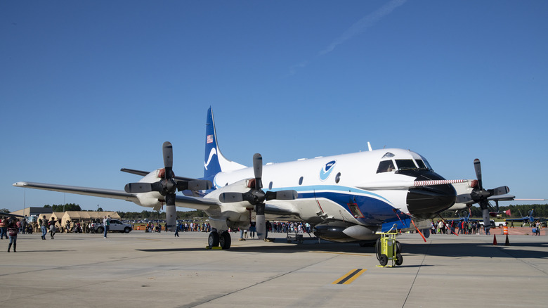
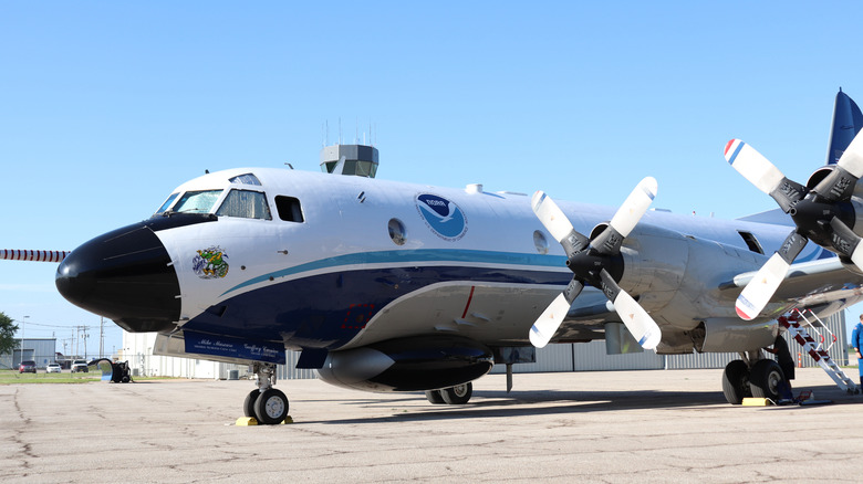
The mission of the National Oceanic & Atmospheric Administration (NOAA) is "To understand and predict changes in climate, weather, ocean, and coasts, to share that knowledge and information with others, and to conserve and manage coastal and marine ecosystems and resources," and occasionally dropping someone's ashes into 179-mph hurricane winds. Helping accomplish that mission are its Hurricane Hunters, led by a pair of Lockheed WP-3D airplanes that each boast four Rolls-Royce T56-14 Series 3.5 turboprop engines. As a result, they have a top speed of 250 knots, a range of 3,800 nautical miles, and a ceiling of 27,000 feet.
Just as vital is their equipment. Each plane packs multiple radar systems that can scan the area vertically and horizontally to develop what the NOAA calls an "MRI-like" image of the storm. In addition, Step Frequency Microwave Radiometers are on board to measure sea-foam radiation caused by high winds on the water's surface, as are deployable bathythermographs for measuring water temperature and windsondes that parachute down to the surface, taking weather readings during their descent.
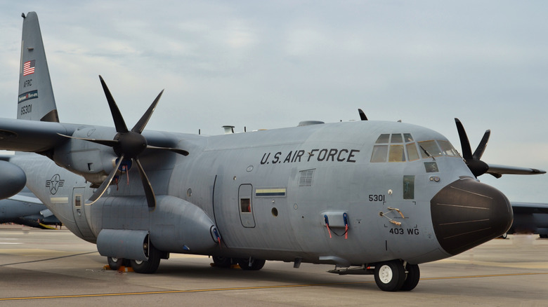
Doing similar work is the 53rd Weather Reconnaissance Squadron out of Keesler Air Force Base in Biloxi, Miss. — and they fly planes with similar turboprop engines. Also known as the Hurricane Hunters, the team relies on 10 of Lockheed's WC-130J, aircraft motivated by four Rolls-Royce AE 2100D3 turboprops. Due to their ability to work efficiently and safely in extreme conditions, propellers are likely to remain the gold standard for weather planes as we continue to navigate stronger and stronger storms.