

Ancient Rome Built 190,000 Miles Of Roads And Researchers Just Traced Them All
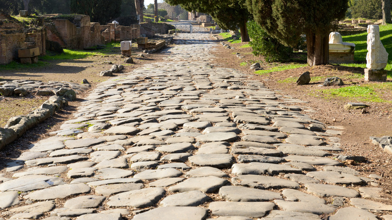
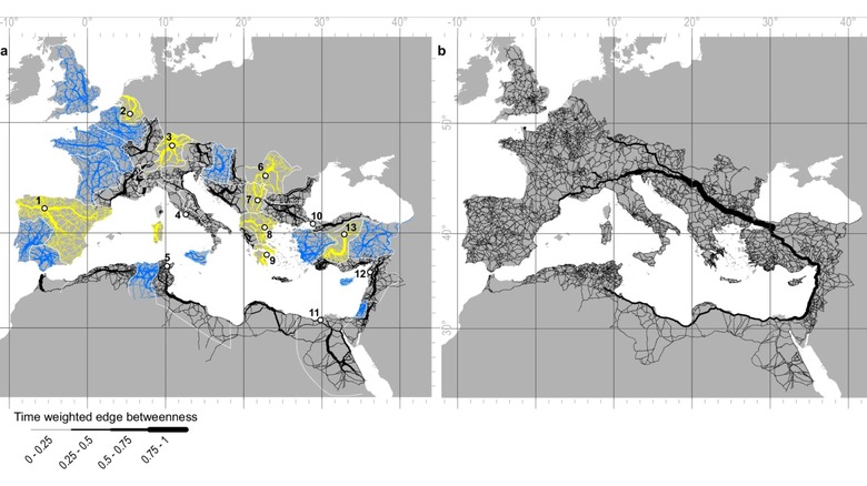
It's no easy feat to build a roadway let alone a highway system — especially one that stretches across a continent. Rome wasn't built in a day, and neither were the 190,000 miles of roads that once connected almost 3.5 million square miles of land through the Roman Empire. Reuters reports researchers just mapped the network of roads that Romans connected across Europe to parts of the Middle East and Northern Africa to better understand the world's first continental travel route, and find out if all roads do indeed lead to Rome. It turns out they don't.
The study published earlier this week mapped out the roads into what the Roman network could have looked like at the peak of the empire's power, sometime between the 2nd to 4th centuries AD. That network of main roads and little countryside paths didn't centralize in Rome, though. Tom Brughmans, classical archaeologist at Aarhus University in Denmark and one of the leads on the project, told Reuters that, "...when we consider all movement within the entire Italian peninsula, we were shocked to discover that the most central road actually follows the opposite Adriatic coastline, bypassing Rome altogether."
The roads of the empire actually met in Constantinople, or Istanbul, Turkey, as it is known today. There the city was more centrally located, as it bordered both Europe and Asia along the Bosporus Strait, where ancient ferries were known to easily traverse between the two continents.
The long, straight roads of the Roman Empire
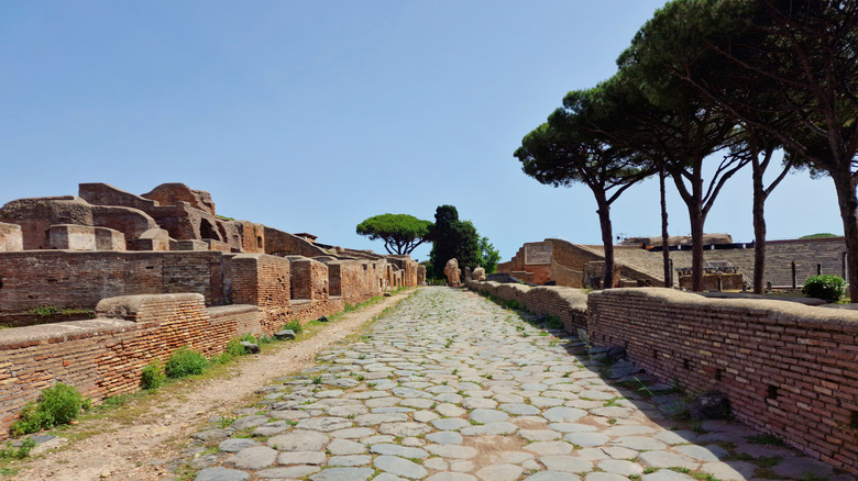
Roman engineers of the time were limited to straight roads thanks to tools like the groma, an ancient surveying tool that was good for straight lines and angles, but not so good at seeing around curves. The lay of the land also played a big part in how the roads were placed, as the Romans couldn't really build through the mountains. If there were a mountain or valley path, the road could follow a switchback or zig-zag pattern, connecting straight road to straight road on its way up or down. Blasting a mountain apart, or even trying to cut through it, wasn't really an option. They also avoided steep slopes to make it easier to traverse by foot or for pulling a cart.
Building a road some two thousand plus years ago wasn't entirely far off from what we use to build roads today, either. Far more rudimentary, materials consisted of lime, cement, gravel, crushed stone and paving stones. History states that many of these roads remained in use beyond the fall of the Western Roman Empire in 476 AD, and the Byzantine Empire's fall in 1453 AD, and remained a crucial part of European travel and communications until the development of the railroad system in the 1800s and the highway system in the 20th century. Much of the highway system traversed in Europe today was found to have been built along these ancient roadways, some of which are still intact today.
A first in moving goods and people by land
Researchers found some of these road systems had already been established prior to the Romans connecting them, such as in ancient Britain and Egypt. But as the empire expanded, so did its network. Some throughways even featured early versions of common highway features we see today like mile markers, signs marking distances, and rest stops. Romans created and installed milestones (actually made of stone) with distances to the nearest cities inscribed on them in Latin. They also built little forts along desert routes for travelers to rest and stock up on supplies or take shelter from unforgiving sandstorms.
These ancient Roman roadways were crucial for the entire empire to move people and goods. "This infrastructure meant that a vast region became more tightly integrated: it provided a continent-sized platform for people, animals, pathogens, goods and ideas to spread," Brughmans said. "The Roman legions marched over roads to respond to threats, relieve colleagues and colonize new territories. Radical new ideas like early Christianity moved with people over land and sea. But the roads themselves were most used for the frequent commutes between farm and field, or to local markets for selling produce."
While researchers have an idea as to how Romans would have built these roads and now have a map of them, questions remain on how the empire would have mapped it out themselves, or if they were even capable of producing a map to attempt something so detailed and planned. For now, it's believed planning these roadways was at a provincial level, and Romans simply connected the dots to its own central station. But more research could be done in the future to hopefully find out just how they mastered such a massive feat. It's not like they had GPS — they basically just had the stars, and eventually their own milestones.